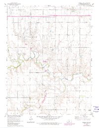
1961 Map of Russell SW
USGS Topo · Published 1980About this map
The Smoky Hill River meanders across the southern portion of this landscape, its path marked by numerous sandpits and gravel extractions that speak to the local geology. This 1961 survey, updated in the late 1970s, captures the rural character of the Russell vicinity as the Oil Field and its accompanying Oil Wells and Pumping Station defined the industrial footprint of the county.
Find a feature on this map
18 named features on this map. Tap any name to fly to it.
Don’t see what you’re looking for? This feature index may not catch every label — zoom into the map to look around manually.
Map Details
Editions of this 1961 Russell SW Map
2 editions found
Other maps of this area

1896 · Russell
USGS Topo · 1:125,000

1896 · Hays
USGS Topo · 1:125,000

1955 · Great Bend
USGS Topo · 1:250,000

1957 · Great Bend
USGS Topo · 1:250,000

1958 · Great Bend
USGS Topo · 1:250,000
1961 · Walker
USGS Topo · 1:24,000

1961 · Russell SW
USGS Topo · 1:24,000

1961 · Homer
USGS Topo · 1:24,000

1967 · Russell NW
USGS Topo · 1:24,000

1967 · Russell
USGS Topo · 1:24,000