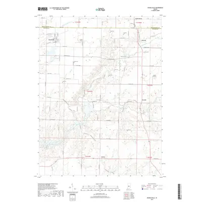
2019 Map of Russellville
USGS Topo · Published 2019About this map
Big Raccoon Creek and its many tributaries, including Byrd Br and Ramp Creek, carve a complex drainage pattern across this Montgomery and Putnam County borderland. The town of Russellville serves as a primary hub, showing a traditional street grid with Railroad St and N Harrison St at its core. This landscape is notably dense with small family and community burial grounds, such as Hebron Cem, LaFollette Cem, and Peffley Cem, which provide essential touchstones for genealogical research in the area.
Find a feature on this map
87 named features on this map. Tap any name to fly to it.
Don’t see what you’re looking for? This feature index may not catch every label — zoom into the map to look around manually.
Map Details
Editions of this 2019 Russellville Map
This is the sole edition of this map. No revisions or reprints were ever made.
Other maps of this area

1949 · Alamo
USGS Topo · 1:24,000

1951 · Clinton Falls
USGS Topo · 1:24,000

1951 · Mansfield
USGS Topo · 1:24,000

1953 · Indianapolis
USGS Topo · 1:250,000

1955 · Russellville
USGS Topo · 1:24,000

1956 · Indianapolis
USGS Topo · 1:250,000

1956 · New Market
USGS Topo · 1:24,000

1957 · Indianapolis
USGS Topo · 1:250,000

1958 · Roachdale
USGS Topo · 1:24,000

1958 · Ladoga
USGS Topo · 1:24,000