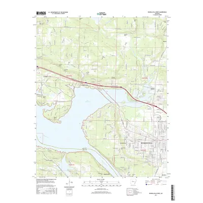
2017 Map of Russellville West
USGS Topo · Published 2017About this map
Russellville and the winding course of the Arkansas River dominate this landscape, showing the city's western expansion toward the waters of Lake Dardanelle. This 2017 survey details the urban interface between the Arkansas Tech Univ campus and the surrounding natural landmarks, including Norristown Mtn and Bunker Hill. The map serves as a vital record for genealogists, as it identifies numerous burial grounds such as Oakland Cem, Reed Cem, and Old Post, alongside smaller family or community sites like Ball Hill Cem and Mission Cem.
Find a feature on this map
253 named features on this map. Tap any name to fly to it.
Don’t see what you’re looking for? This feature index may not catch every label — zoom into the map to look around manually.
Map Details
Editions of this 2017 Russellville West Map
This is the sole edition of this map. No revisions or reprints were ever made.
Other maps of this area

1888 · Dardanelle #4
USGS Topo · 1:62,500

1888 · Dardanelle #2
USGS Topo · 1:62,500

1888 · Dardanelle #1
USGS Topo · 1:62,500

1888 · Dardanelle #3
USGS Topo · 1:62,500

1890 · Dardanelle
USGS Topo · 1:125,000

1956 · Russellville
USGS Topo · 1:250,000
1961 · Dover
USGS Topo · 1:24,000
1962 · Knoxville
USGS Topo · 1:24,000
1962 · Russellville East
USGS Topo · 1:24,000

1962 · Delaware
USGS Topo · 1:24,000