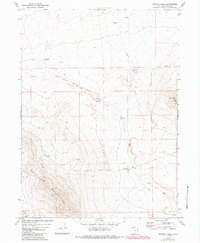
1971 Map of Russian Knoll
USGS Topo · Published 1984About this map
The Maitlin Mountains and Russian Knoll define this high desert landscape in northwestern Utah as it appeared during the early 1970s. The area is characterized by sparse water resources and isolated ranching infrastructure, such as the Board Ranch and the Dove Creek Well. Several small-scale water management features are evident, including the Baker Hills Reservoir and Trail Pass Reservoir, which supported the livestock and limited human presence in this arid region.
Find a feature on this map
26 named features on this map. Tap any name to fly to it.
Don’t see what you’re looking for? This feature index may not catch every label — zoom into the map to look around manually.
Map Details
Editions of this 1971 Russian Knoll Map
2 editions found
Other maps of this area

1954 · Brigham City
USGS Topo · 1:250,000

1958 · Brigham City
USGS Topo · 1:250,000

1959 · Kelton Pass
USGS Topo · 1:62,500

1959 · Park Valley
USGS Topo · 1:62,500

1962 · Brigham City
USGS Topo · 1:250,000

1969 · Peplin Flats
USGS Topo · 1:24,000

1969 · Hogup Bar
USGS Topo · 1:24,000

1971 · Red Dome
USGS Topo · 1:24,000

1971 · Matlin
USGS Topo · 1:24,000
1971 · Runswick Wash
USGS Topo · 1:24,000