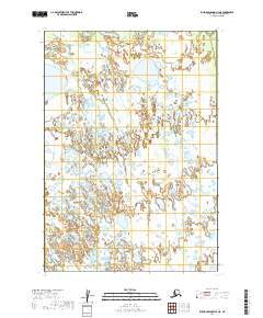
2019 Map of Russian Mission B-2 NE
USGS Topo · Published 2019About this map
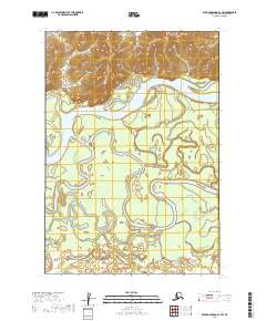
Wetlands and intricate water systems dominate this portion of the Russian Mission B-2 NE quadrangle within the Bethel Census Area. The landscape is defined by the wandering path of Swift Creek, which meanders through a dense network of marshes and small ponds. Further west, Discovery Creek drains the northern reaches of the terrain. The map serves as a record of the intricate hydrography of the Yukon-Kuskokwim Delta region, illustrating the complex drainage patterns before seasonal changes or larger ecological shifts alter the surface water. This area remains largely unsettled, with its character defined by the remote intersection of township boundaries t16n r57w and t15n r57w.
Find a feature on this map
6 named features on this map. Tap any name to fly to it.
Don’t see what you’re looking for? This feature index may not catch every label — zoom into the map to look around manually.
Map Details
Editions of this 2019 Russian Mission B-2 NE Map
This is the sole edition of this map. No revisions or reprints were ever made.
Other maps of this area

1947 · Russian Mission
USGS Topo · 1:250,000

1950 · Russian Mission
USGS Topo · 1:250,000

1952 · Russian Mission C-1
USGS Topo · 1:63,360

1952 · Russian Mission C-2
USGS Topo · 1:63,360

1952 · Russian Mission B-2
USGS Topo · 1:63,360
1952 · Russian Mission B-1
USGS Topo · 1:63,360

1980 · Russian Mission
USGS Topo · 1:250,000
2019 · Russian Mission B-1 SW
USGS Topo · 1:25,000
2019 · Russian Mission C-2 SE
USGS Topo · 1:25,000
2019 · Russian Mission C-2 SW
USGS Topo · 1:25,000