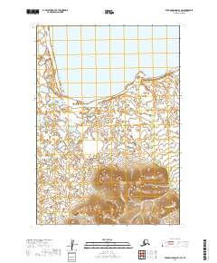
2019 Map of Russian Mission B-3 SW
USGS Topo · Published 2019About this map
Whitefish Lake dominates the northern reaches of this Bethel Census Area landscape, where the open water gives way to a complex network of wetlands and tundra. The terrain is defined by the drainage of Ophir Cr, which meanders through the eastern sections of the quadrangle. The map captures a largely unsettled wilderness within the Yukon-Kuskokwim Delta region, illustrating the intricate hydrography of small ponds and saturated flats that characterize this part of Alaska. Moving south, the topography transitions into a series of distinct hills, with contour lines indicating significant elevation gains compared to the northern lake basin. This contrast highlights the geographical transition from the lowland lake systems to the upland ridges that overlook the vast surrounding marshlands.
Find a feature on this map
10 named features on this map. Tap any name to fly to it.
Don’t see what you’re looking for? This feature index may not catch every label — zoom into the map to look around manually.
Map Details
Editions of this 2019 Russian Mission B-3 SW Map
This is the sole edition of this map. No revisions or reprints were ever made.
Other maps of this area

1947 · Russian Mission
USGS Topo · 1:250,000

1950 · Russian Mission
USGS Topo · 1:250,000

1952 · Russian Mission B-3
USGS Topo · 1:63,360

1954 · Russian Mission A-4
USGS Topo · 1:63,360

1954 · Russian Mission B-4
USGS Topo · 1:63,360

1954 · Russian Mission A-3
USGS Topo · 1:63,360

1980 · Russian Mission
USGS Topo · 1:250,000
2017 · Russian Mission B-4 NE
USGS Topo · 1:25,000
2017 · Russian Mission A-4 NE
USGS Topo · 1:25,000
2017 · Russian Mission B-4 SE
USGS Topo · 1:25,000