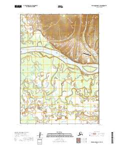
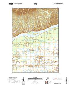
2019 Map of Russian Mission C-1 SW
USGS Topo · Published 2019About this map
Chuathbaluk sits along the northern bank of the Kuskokwim River, serving as a central point of settlement in this landscape of braided waterways and marshy lowlands. The village infrastructure is concentrated near the river, featuring the Saint Sergius Church and a nearby Graveyard, reflecting the community's cultural and religious foundations. Transportation in this region is primarily aerial and water-based, anchored by the Chuathbaluk Airport and local transit ways like the Chuathbaluk Road and Airport Access Road.
Find a feature on this map
16 named features on this map. Tap any name to fly to it.
Don’t see what you’re looking for? This feature index may not catch every label — zoom into the map to look around manually.
Map Details
Editions of this 2019 Russian Mission C-1 SW Map
This is the sole edition of this map. No revisions or reprints were ever made.
Other maps of this area

1947 · Russian Mission
USGS Topo · 1:250,000

1950 · Russian Mission
USGS Topo · 1:250,000

1952 · Russian Mission C-1
USGS Topo · 1:63,360

1952 · Russian Mission C-2
USGS Topo · 1:63,360

1952 · Russian Mission B-2
USGS Topo · 1:63,360
1952 · Russian Mission B-1
USGS Topo · 1:63,360

1980 · Russian Mission
USGS Topo · 1:250,000
2019 · Russian Mission C-1 NW
USGS Topo · 1:25,000
2019 · Russian Mission C-2 SE
USGS Topo · 1:25,000
2019 · Russian Mission C-1 SE
USGS Topo · 1:25,000