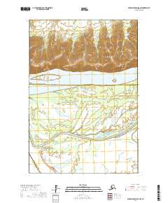
2017 Map of Russian Mission D-4 NW
USGS Topo · Published 2017About this map
The Yukon River flows through this 2017 landscape, serving as a primary boundary between the Yukon-Koyukuk Census Area to the north and the Bethel Census Area to the south. The terrain is characterized by the complex hydrography of the river valley, where Twelvemile Slough weaves through the southern lowlands. North of the main channel, the elevation rises toward the hills where Mountain Cr drains the southern slopes of the uplands.
Find a feature on this map
9 named features on this map. Tap any name to fly to it.
Don’t see what you’re looking for? This feature index may not catch every label — zoom into the map to look around manually.
Map Details
Editions of this 2017 Russian Mission D-4 NW Map
This is the sole edition of this map. No revisions or reprints were ever made.
Other maps of this area

1947 · Russian Mission
USGS Topo · 1:250,000

1950 · Russian Mission
USGS Topo · 1:250,000

1951 · Holy Cross
USGS Topo · 1:250,000

1952 · Holy Cross A-4
USGS Topo · 1:63,360

1952 · Holy Cross A-3
USGS Topo · 1:63,360

1952 · Holy Cross
USGS Topo · 1:250,000

1952 · Russian Mission D-4
USGS Topo · 1:63,360
1952 · Russian Mission D-5
USGS Topo · 1:63,360

1980 · Russian Mission
USGS Topo · 1:250,000
2017 · Russian Mission D-5 SE
USGS Topo · 1:25,000