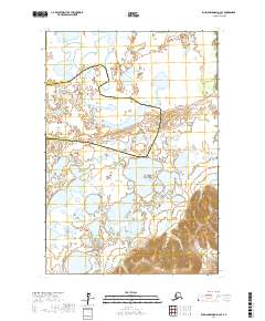
2017 Map of Russian Mission D-4 SE
USGS Topo · Published 2017About this map
The Talbiksok River winds through this expanse of the Yukon-Kuskokwim Delta, defining a landscape dominated by complex wetland systems and glacial-fed hydrology. This 2017 survey documents a transition zone between the Bethel Census Area and the Kusilvak Census Area, where the low-lying terrain is marked by hundreds of unnamed lakes and ponds. The topographic data reveals the subtle shifts in drainage patterns and seasonal water bodies that characterize this remote Alaskan interior. While the map lacks formal settlements, it provides critical geographic detail for understanding the land-use boundaries and natural watercourses that sustain the region's traditional subsistence activities.
Find a feature on this map
9 named features on this map. Tap any name to fly to it.
Don’t see what you’re looking for? This feature index may not catch every label — zoom into the map to look around manually.
Map Details
Editions of this 2017 Russian Mission D-4 SE Map
This is the sole edition of this map. No revisions or reprints were ever made.
Other maps of this area

1947 · Russian Mission
USGS Topo · 1:250,000

1950 · Russian Mission
USGS Topo · 1:250,000

1952 · Russian Mission D-3
USGS Topo · 1:63,360

1952 · Russian Mission C-3
USGS Topo · 1:63,360

1952 · Russian Mission D-4
USGS Topo · 1:63,360

1954 · Russian Mission C-4
USGS Topo · 1:63,360

1980 · Russian Mission
USGS Topo · 1:250,000
2017 · Russian Mission D-4 NW
USGS Topo · 1:25,000
2017 · Russian Mission D-4 SW
USGS Topo · 1:25,000
2017 · Russian Mission D-4 NE
USGS Topo · 1:25,000