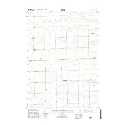
2017 Map of Ruth
USGS Topo · Published 2017About this map
Ruth and Charleston anchor this agricultural landscape in the Thumb region of Michigan, where a grid of section-line roads defines the local geography. The map reveals a high density of rural religious and commemorative sites, including Saints Peter and Paul Cem, Immanuel Cem, and West Delaware Cem, indicating the deep-rooted settlement patterns of the local townships. The terrain is carved by a network of small waterways such as the White River, Slate Stone Cr, and White Rock Cr, which wind through the township blocks toward Lake Huron. The Huron Co Sanilac Co line divides the southern portion of the sheet, while family-named roads like Conquergood Rd and Eppenbrock Rd provide valuable links for genealogists tracing local land ownership and ancestral homesteads in this 2017 topographic study.
Find a feature on this map
58 named features on this map. Tap any name to fly to it.
Don’t see what you’re looking for? This feature index may not catch every label — zoom into the map to look around manually.
Map Details
Editions of this 2017 Ruth Map
This is the sole edition of this map. No revisions or reprints were ever made.
Other maps of this area

1954 · Flint
USGS Topo · 1:250,000

1958 · Flint
USGS Topo · 1:250,000

1963 · Forestville
USGS Topo · 1:24,000

1963 · Ruth
USGS Topo · 1:24,000

1963 · Minden City
USGS Topo · 1:24,000

1963 · Palms
USGS Topo · 1:24,000

1963 · Deckerville
USGS Topo · 1:24,000

1963 · Richmondville
USGS Topo · 1:24,000

1970 · Harbor Beach
USGS Topo · 1:24,000

1970 · Bad Axe SE
USGS Topo · 1:24,000