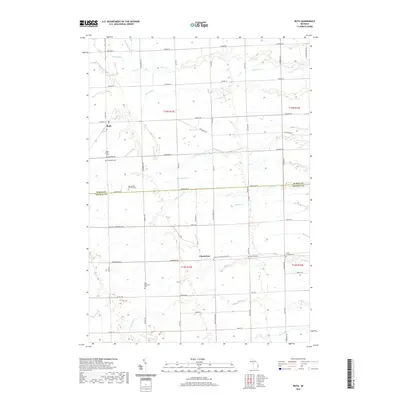
2019 Map of Ruth
USGS Topo · Published 2019About this map
The agricultural landscape of Ruth and Charleston is defined by a dense grid of farm-to-market roads and an intricate network of drainage systems. At the northern edge of the map, the headwaters of the White River and Sucker Cr are supplemented by man-made alterations like the Sherman Drain and Smith Drain, reflecting the region’s long history of land reclamation for productive tillage. This survey documents the rural character of the area where Huron Co meets Sanilac Co.
Find a feature on this map
61 named features on this map. Tap any name to fly to it.
Don’t see what you’re looking for? This feature index may not catch every label — zoom into the map to look around manually.
Map Details
Editions of this 2019 Ruth Map
This is the sole edition of this map. No revisions or reprints were ever made.
Other maps of this area

1954 · Flint
USGS Topo · 1:250,000

1958 · Flint
USGS Topo · 1:250,000

1963 · Forestville
USGS Topo · 1:24,000

1963 · Ruth
USGS Topo · 1:24,000

1963 · Minden City
USGS Topo · 1:24,000

1963 · Palms
USGS Topo · 1:24,000

1963 · Deckerville
USGS Topo · 1:24,000

1963 · Richmondville
USGS Topo · 1:24,000

1970 · Harbor Beach
USGS Topo · 1:24,000

1970 · Bad Axe SE
USGS Topo · 1:24,000