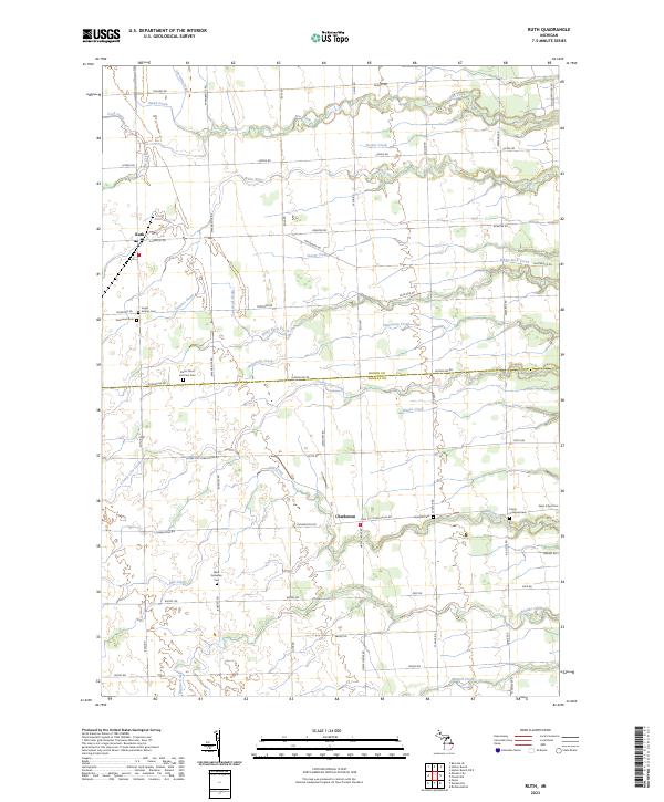
2023 Map of Ruth
USGS Topo · Published 2023About this map
Ruth and Charleston anchor this agricultural landscape along the Huron Co Sanilac Co line in Michigan's Thumb region. The map details a well-ordered township grid defined by family-named roads like Eppenbrock Rd, S Klug Rd, and Burgess Rd. This rural survey is particularly dense with genealogical sites, featuring numerous religious and community burial grounds such as Saints Peter and Paul Cem, Trinity Lutheran Cem, and the West Delaware Cem. A complex drainage network defines the terrain, where headwaters for the White River, White Rock Creek, and Mill Creek cut through the farmland. These waterways, including minor systems like Sucker Creek and Slatestone Creek, dictate the placement of early farmsteads and the meandering paths of the region's historical drainage ditches.
Find a feature on this map
60 named features on this map. Tap any name to fly to it.
Don’t see what you’re looking for? This feature index may not catch every label — zoom into the map to look around manually.
Map Details
Editions of this 2023 Ruth Map
This is the sole edition of this map. No revisions or reprints were ever made.
Other maps of this area

1954 · Flint
USGS Topo · 1:250,000

1958 · Flint
USGS Topo · 1:250,000

1963 · Forestville
USGS Topo · 1:24,000

1963 · Ruth
USGS Topo · 1:24,000

1963 · Minden City
USGS Topo · 1:24,000

1963 · Palms
USGS Topo · 1:24,000

1963 · Deckerville
USGS Topo · 1:24,000

1963 · Richmondville
USGS Topo · 1:24,000

1970 · Harbor Beach
USGS Topo · 1:24,000

1970 · Bad Axe SE
USGS Topo · 1:24,000