
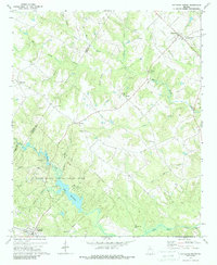
1971 Map of Rutledge North
USGS Topo · Published 1974About this map
Bostwick and Rutledge anchor the northern and southern reaches of this landscape, separated by a rolling network of small streams and community landmarks. The southern portion of the sheet is dominated by Hard Labor Creek State Park, featuring Lake Rutledge and several specialized facilities like Camp Daniel Morgan and Camp Rutledge. The area’s agrarian roots are evidenced by the numerous country churches and cemeteries that define local social geography, including Gibbs Memorial Ch and Gresham Grove Ch.
Find a feature on this map
39 named features on this map. Tap any name to fly to it.
Don’t see what you’re looking for? This feature index may not catch every label — zoom into the map to look around manually.
Map Details
Editions of this 1971 Rutledge North Map
2 editions found
Other maps of this area

1896 · Monroe
USGS Topo · 1:125,000

1953 · Athens
USGS Topo · 1:250,000

1958 · Athens
USGS Topo · 1:250,000

1959 · Athens
USGS Topo · 1:250,000

1963 · Athens
USGS Topo · 1:250,000

1964 · High Shoals
USGS Topo · 1:24,000

1964 · Watkinsville
USGS Topo · 1:24,000

1964 · Monroe
USGS Topo · 1:24,000
1971 · Social Circle
USGS Topo · 1:24,000

1972 · Apalachee
USGS Topo · 1:24,000