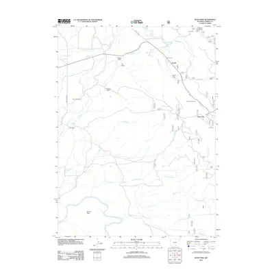
2012 Map of Ryan Park
USGS Topo · Published 2012About this map
Ryan Park and the high-elevation ranching country of Carbon County are defined by a complex network of water management and seasonal recreation. Water engineering is central to this landscape, as seen in the Stewart Ditch, Wiant Ditch, and Cook Ditch, which divert mountain flows across the drainages of the N Platte River and its many tributaries like Beaver Cr and Brush Cr. These irrigation systems support working properties such as the Brush Creek Ranch and Condict Ranch.
Find a feature on this map
59 named features on this map. Tap any name to fly to it.
Don’t see what you’re looking for? This feature index may not catch every label — zoom into the map to look around manually.
Map Details
Editions of this 2012 Ryan Park Map
This is the sole edition of this map. No revisions or reprints were ever made.
Other maps of this area

1906 · Medicine Bow
USGS Topo · 1:125,000

1908 · Medicine Bow
USGS Topo · 1:125,000

1939 · Saratoga
USGS Topo · 1:125,000

1954 · Rawlins
USGS Topo · 1:250,000

1958 · Rawlins
USGS Topo · 1:250,000

1961 · Overlook Hill
USGS Topo · 1:24,000

1961 · Ryan Park
USGS Topo · 1:24,000
1961 · Kennaday Peak
USGS Topo · 1:24,000
1961 · Finley Reservoir
USGS Topo · 1:24,000

1961 · Gunst Reservoir
USGS Topo · 1:24,000