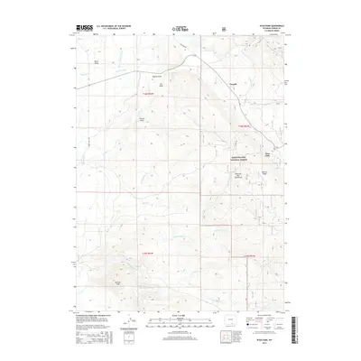
2015 Map of Ryan Park
USGS Topo · Published 2015About this map
Medicine Bow National Forest dominates this section of the Medicine Bow Mountains in Carbon County, where the settlement of Ryan Park and the locality of Tenmile are situated. The landscape is defined by an intricate network of water management and natural drainages, including the Wiant and Highline Ditch, Stewart Ditch, and Cook Ditch, which redirect water across the high terrain. The North Platte River flows through the southwestern corner near Bennett Peak, while various canyons and gulches like Buffalo Gulch and Francis Draw carve the mountain slopes. This 2015 survey illustrates the modern intersection of forest management, recreation, and historical water rights in a region where Barrett Ridge and Reynolds Run mark the transition from high peaks to the river valley.
Find a feature on this map
34 named features on this map. Tap any name to fly to it.
Don’t see what you’re looking for? This feature index may not catch every label — zoom into the map to look around manually.
Map Details
Editions of this 2015 Ryan Park Map
This is the sole edition of this map. No revisions or reprints were ever made.
Other maps of this area
1906 · Medicine Bow
USGS Topo · 1:125,000
1908 · Medicine Bow
USGS Topo · 1:125,000
1939 · Saratoga
USGS Topo · 1:125,000
1954 · Rawlins
USGS Topo · 1:250,000
1958 · Rawlins
USGS Topo · 1:250,000
1961 · Overlook Hill
USGS Topo · 1:24,000
1961 · Ryan Park
USGS Topo · 1:24,000
1961 · Kennaday Peak
USGS Topo · 1:24,000
1961 · Finley Reservoir
USGS Topo · 1:24,000
1961 · Gunst Reservoir
USGS Topo · 1:24,000