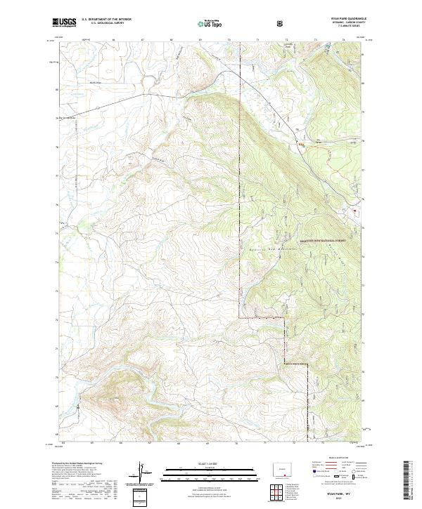
2021 Map of Ryan Park
USGS Topo · Published 2021About this map
Medicine Bow National Forest dominates this landscape in Carbon County, where high-elevation drainage systems define the rugged Wyoming terrain. The North Platte River winds across the southern reaches of the map, fed by a complex network of seasonal and perennial streams including N Cottonwood Cr and S Fork Corral Cr. The area’s water management history is etched into the earth through features like Wiant Ditch, Cook Ditch, and Stewart Ditch, which redirect snowmelt from the Medicine Bow Mountains to support regional needs.
Find a feature on this map
37 named features on this map. Tap any name to fly to it.
Don’t see what you’re looking for? This feature index may not catch every label — zoom into the map to look around manually.
Map Details
Editions of this 2021 Ryan Park Map
This is the sole edition of this map. No revisions or reprints were ever made.
Other maps of this area

1906 · Medicine Bow
USGS Topo · 1:125,000

1908 · Medicine Bow
USGS Topo · 1:125,000

1939 · Saratoga
USGS Topo · 1:125,000

1954 · Rawlins
USGS Topo · 1:250,000

1958 · Rawlins
USGS Topo · 1:250,000

1961 · Overlook Hill
USGS Topo · 1:24,000

1961 · Ryan Park
USGS Topo · 1:24,000
1961 · Kennaday Peak
USGS Topo · 1:24,000
1961 · Finley Reservoir
USGS Topo · 1:24,000

1961 · Gunst Reservoir
USGS Topo · 1:24,000