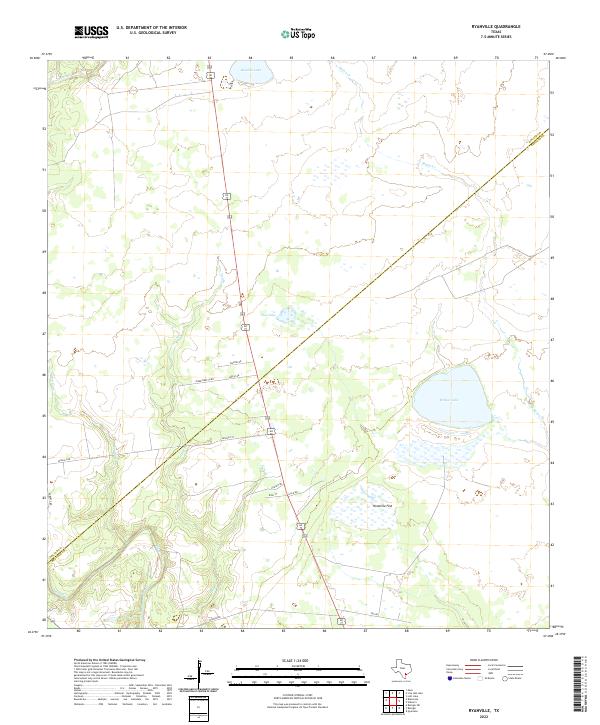
2022 Map of Ryanville
USGS Topo · Published 2022About this map
Willow Lake and the broad expanse of Ninemile Flat anchor this South Texas landscape where the coastal plains meet the interior drainages of the Goliad and Refugio county line. The hydrology of the region is defined by a network of intermittent waterways, including Sarco Cr and Melon Cr, which feed into isolated basins like Bundick Lake and Flat Lake. These water features suggest a landscape traditionally tied to livestock and seasonal grazing, where water management is critical to the local economy.
Find a feature on this map
21 named features on this map. Tap any name to fly to it.
Don’t see what you’re looking for? This feature index may not catch every label — zoom into the map to look around manually.
Map Details
Editions of this 2022 Ryanville Map
This is the sole edition of this map. No revisions or reprints were ever made.
Other maps of this area

1953 · Beeville
USGS Topo · 1:250,000

1954 · Vidaurri
USGS Topo · 1:62,500

1954 · Refugio
USGS Topo · 1:62,500

1956 · Beeville
USGS Topo · 1:250,000

1960 · Beeville
USGS Topo · 1:250,000

1962 · Live Oak Lake
USGS Topo · 1:24,000

1962 · Lott Lake
USGS Topo · 1:24,000

1962 · Melo
USGS Topo · 1:24,000

1978 · Ryanville
USGS Topo · 1:24,000

1978 · Vidaurri
USGS Topo · 1:24,000