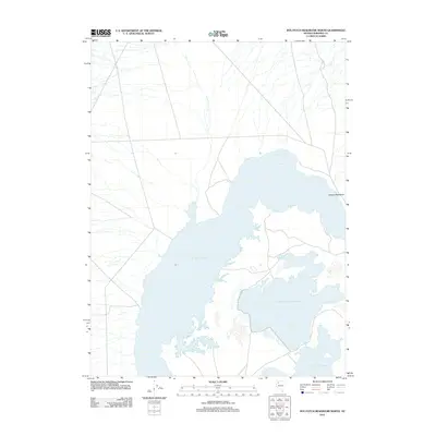
2011 Map of Rye Patch Reservoir North
USGS Topo · Published 2011About this map
Rye Patch Reservoir dominates this Pershing County landscape, where the storage of water transformed the high desert environment. The reservoir's eastern shoreline is shaped by the expansive Majuba Bay, while the historical memory of the region's emigrant trails is preserved in the name Lassens Meadows. This area served as a critical waypoint for travelers during the westward expansion, providing water and forage before the crossing of the Black Rock Desert. Further south and east, the Upper Pitt-Taylor Reservoir and the northern edge of the Lower Pitt-Taylor Reservoir illustrate the extensive irrigation and water management infrastructure developed to support agricultural efforts in the Great Basin. The grid of roads and surveyed lines highlights the 21st-century management of these vital desert resources.
Find a feature on this map
5 named features on this map. Tap any name to fly to it.
Don’t see what you’re looking for? This feature index may not catch every label — zoom into the map to look around manually.
Map Details
Editions of this 2011 Rye Patch Reservoir North Map
This is the sole edition of this map. No revisions or reprints were ever made.
Other maps of this area

1931 · Lovelock
USGS Topo · 1:250,000

1935 · Lovelock
USGS Topo · 1:250,000

1939 · Eugene Mountains Area
USGS Topo · 1:62,500

1942 · Eugene Mountains Area
USGS Topo · 1:62,500

1955 · Lovelock
USGS Topo · 1:250,000

1956 · Imlay
USGS Topo · 1:62,500

1959 · Lovelock
USGS Topo · 1:250,000

1971 · Majuba Mtn
USGS Topo · 1:24,000

1971 · Rye Patch Reservoir South
USGS Topo · 1:24,000

1971 · Poker Brown
USGS Topo · 1:24,000