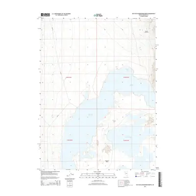
2014 Map of Rye Patch Reservoir North
USGS Topo · Published 2014About this map
The expansive waters of Rye Patch Reservoir dominate the landscape of the Humboldt Valley in Pershing County. This northern reach of the reservoir includes the distinct Majuba Bay and the storied Lassens Meadows, a historically significant waypoint along the Humboldt River route where travelers found water and forage for livestock. To the northeast, the terrain rises sharply into the Eugene Mountains, providing a stark contrast to the flat, riparian corridor. The map also captures the Upper Pitt- Taylor Reservoir, illustrating the essential water management infrastructure that supports this arid region. For researchers, the presence of Etna Rd and Jungo Rd provides a sense of the modern transportation network overlaying this ancient river valley path.
Find a feature on this map
12 named features on this map. Tap any name to fly to it.
Don’t see what you’re looking for? This feature index may not catch every label — zoom into the map to look around manually.
Map Details
Editions of this 2014 Rye Patch Reservoir North Map
This is the sole edition of this map. No revisions or reprints were ever made.
Other maps of this area

1931 · Lovelock
USGS Topo · 1:250,000

1935 · Lovelock
USGS Topo · 1:250,000

1939 · Eugene Mountains Area
USGS Topo · 1:62,500

1942 · Eugene Mountains Area
USGS Topo · 1:62,500

1955 · Lovelock
USGS Topo · 1:250,000

1956 · Imlay
USGS Topo · 1:62,500

1959 · Lovelock
USGS Topo · 1:250,000

1971 · Majuba Mtn
USGS Topo · 1:24,000

1971 · Rye Patch Reservoir South
USGS Topo · 1:24,000

1971 · Poker Brown
USGS Topo · 1:24,000