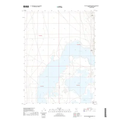
2018 Map of Rye Patch Reservoir North
USGS Topo · Published 2018About this map
Humboldt River waters dominate this Pershing County landscape, feeding into a complex system of high-desert impoundments. The map details the northern reaches of the Rye Patch Reservoir, including the distinct indent of Majuba Bay. Further east, the Upper Pitt-Taylor Reservoir and the northern edge of the Lower Pitt-Taylor Reservoir illustrate the intensive water management required in the Humboldt Valley. Historically significant Lassens Meadows is located along the river's path, marking a vital waypoint for travelers in this arid region. The eastern slopes of the Eugene Mountains rise in the northeast corner, where Dry Cr descends toward the valley floor. This 2018 survey provides a modern look at how these massive reservoirs have reshaped the traditional river basin, covering large sections of the surrounding flats while maintaining the heritage of the early emigrant trails.
Find a feature on this map
13 named features on this map. Tap any name to fly to it.
Don’t see what you’re looking for? This feature index may not catch every label — zoom into the map to look around manually.
Map Details
Editions of this 2018 Rye Patch Reservoir North Map
This is the sole edition of this map. No revisions or reprints were ever made.
Other maps of this area

1931 · Lovelock
USGS Topo · 1:250,000

1935 · Lovelock
USGS Topo · 1:250,000

1939 · Eugene Mountains Area
USGS Topo · 1:62,500

1942 · Eugene Mountains Area
USGS Topo · 1:62,500

1955 · Lovelock
USGS Topo · 1:250,000

1956 · Imlay
USGS Topo · 1:62,500

1959 · Lovelock
USGS Topo · 1:250,000

1971 · Majuba Mtn
USGS Topo · 1:24,000

1971 · Rye Patch Reservoir South
USGS Topo · 1:24,000

1971 · Poker Brown
USGS Topo · 1:24,000