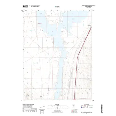
2018 Map of Rye Patch Reservoir South
USGS Topo · Published 2018About this map
Rye Patch Reservoir and the Humboldt River dominate this portion of the Humboldt Valley in Pershing County. This high-desert landscape is defined by its water management and transit corridors, featuring the Lower Pitt-Taylor Reservoir and the distinct Pitt-Taylor Cove to the north. Historical movement through the region is marked by the Old Emigrant Rd, which runs parallel to the modern highway system on the western side of the reservoir. To the west, the foothills of the Trinity Range rise above drainage features like Cavanaugh Wash and Poker Brown Wash. Recreational and geographical landmarks such as Poker Brown Beach illustrate the intersection of the natural basin with 20th-century water reclamation projects, while smaller tributaries like Antelope Cr and Humboldt Cr feed the central waterway system.
Find a feature on this map
21 named features on this map. Tap any name to fly to it.
Don’t see what you’re looking for? This feature index may not catch every label — zoom into the map to look around manually.
Map Details
Editions of this 2018 Rye Patch Reservoir South Map
This is the sole edition of this map. No revisions or reprints were ever made.
Other maps of this area

1931 · Lovelock
USGS Topo · 1:250,000

1935 · Lovelock
USGS Topo · 1:250,000

1954 · Unionville
USGS Topo · 1:62,500

1955 · Lovelock
USGS Topo · 1:250,000

1956 · Oreana
USGS Topo · 1:62,500

1956 · Imlay
USGS Topo · 1:62,500

1959 · Lovelock
USGS Topo · 1:250,000

1971 · Majuba Mtn
USGS Topo · 1:24,000

1971 · Rye Patch Reservoir South
USGS Topo · 1:24,000

1971 · Poker Brown
USGS Topo · 1:24,000