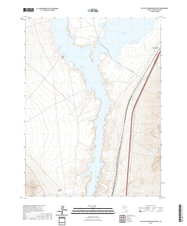
2021 Map of Rye Patch Reservoir South
USGS Topo · Published 2021About this map
Rye Patch Reservoir dominates this high-desert basin, where modern water management shapes the arid Pershing County landscape. The map details the southern reach of the reservoir and the adjacent Lower Pitt-Taylor Reservoir, showing how these impoundments fill the central Humboldt Valley. Along the eastern shore, Pitt-Taylor Cove and Poker Brown Beach provide specific landmarks within the larger hydrological system. To the west, the foothills of the Trinity Range rise sharply from the valley floor, while the eastern side is defined by a corridor of infrastructure including N Frontage Rd and the settlement of Humboldt. This modern survey records the interaction between the seasonal flows of Humboldt Cr and the engineered reservoirs that sustain this portion of the Great Basin.
Find a feature on this map
17 named features on this map. Tap any name to fly to it.
Don’t see what you’re looking for? This feature index may not catch every label — zoom into the map to look around manually.
Map Details
Editions of this 2021 Rye Patch Reservoir South Map
This is the sole edition of this map. No revisions or reprints were ever made.
Other maps of this area

1931 · Lovelock
USGS Topo · 1:250,000

1935 · Lovelock
USGS Topo · 1:250,000

1954 · Unionville
USGS Topo · 1:62,500

1955 · Lovelock
USGS Topo · 1:250,000

1956 · Oreana
USGS Topo · 1:62,500

1956 · Imlay
USGS Topo · 1:62,500

1959 · Lovelock
USGS Topo · 1:250,000

1971 · Majuba Mtn
USGS Topo · 1:24,000

1971 · Rye Patch Reservoir South
USGS Topo · 1:24,000

1971 · Poker Brown
USGS Topo · 1:24,000