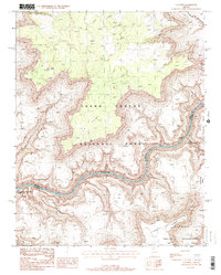
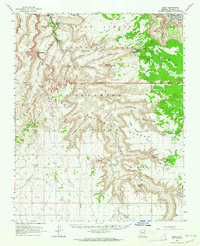
1988 Map of S B Point
USGS Topo · Published 1988About this map
The Colorado River carves a deep path through this section of the Grand Canyon National Park in the late 1980s, revealing a landscape defined by dramatic elevation changes and named geographical markers. From the high plateau of S B Point to the river's edge, the map documents significant whitewater features such as Hundred and Sixtyfour Mile Rapids and Havasu Rapids.
Find a feature on this map
18 named features on this map. Tap any name to fly to it.
Don’t see what you’re looking for? This feature index may not catch every label — zoom into the map to look around manually.
Map Details
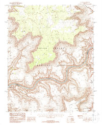
Editions of this 1988 S B Point Map
2 editions found
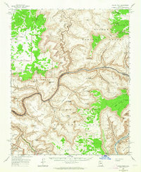
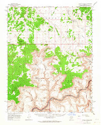
Other maps of this area

1886 · Kaibab
USGS Topo · 1:250,000

1953 · Grand Canyon
USGS Topo · 1:250,000

1957 · Grand Canyon
USGS Topo · 1:250,000

1958 · Grand Canyon
USGS Topo · 1:250,000

1960 · Grand Canyon
USGS Topo · 1:250,000
1962 · Kanab Point
USGS Topo · 1:62,500
1962 · Tuckup Canyon
USGS Topo · 1:62,500
1962 · Supai
USGS Topo · 1:62,500

1962 · National Canyon
USGS Topo · 1:62,500
1984 · Grand Canyon
USGS Topo · 1:100,000