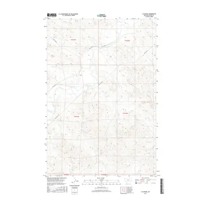
2017 Map of S H School
USGS Topo · Published 2017About this map
S H School serves as a lone institutional landmark in this corner of Custer County, where the high plains are deeply incised by the Tongue River and its network of seasonal tributaries. The landscape is defined by the drainage patterns of Pump Cr, Kelsey Cr, and Coon Cr, which carve through the townships and ranges of the Montana plains. Transportation in the early 21st century follows the water, with the Tongue River Rd and Custer Cty Rd 611 providing the primary transit corridors through the river valley. The map documents a sparse, rural settlement pattern typical of southeastern Montana, where life and labor are organized around the major watercourses and the section lines of the Public Land Survey System. Modern infrastructure is limited to local connectors like Moon Creek Rd, maintaining the area's character as a remote ranching and agricultural territory.
Find a feature on this map
21 named features on this map. Tap any name to fly to it.
Don’t see what you’re looking for? This feature index may not catch every label — zoom into the map to look around manually.
Map Details
Editions of this 2017 S H School Map
This is the sole edition of this map. No revisions or reprints were ever made.
Other maps of this area

1953 · Miles City
USGS Topo · 1:250,000

1954 · Hardin
USGS Topo · 1:250,000

1954 · Ekalaka
USGS Topo · 1:250,000

1954 · Forsyth
USGS Topo · 1:250,000

1956 · Ekalaka
USGS Topo · 1:250,000

1957 · Miles City
USGS Topo · 1:250,000

1957 · Hardin
USGS Topo · 1:250,000

1957 · Forsyth
USGS Topo · 1:250,000

1958 · Miles City
USGS Topo · 1:250,000

1958 · Ekalaka
USGS Topo · 1:250,000