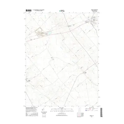
2016 Map of Sabina
USGS Topo · Published 2016About this map
Sabina and its surrounding townships in Clinton County reveal a landscape defined by agricultural tradition and numerous burial grounds. This 2016 survey highlights several small settlements including Reesville, Melvin, and Lees Creek, many of which developed along the rail corridors that traverse the region. A high density of local cemeteries, such as the Richland Methodist Cem, Texas Cem, and Wade Cem, offer significant geographic markers for genealogists tracing family roots in this part of Ohio.
Find a feature on this map
59 named features on this map. Tap any name to fly to it.
Don’t see what you’re looking for? This feature index may not catch every label — zoom into the map to look around manually.
Map Details
Editions of this 2016 Sabina Map
This is the sole edition of this map. No revisions or reprints were ever made.
Other maps of this area

1907 · Blanchester
USGS Topo · 1:62,500

1916 · Octa
USGS Topo · 1:62,500

1917 · Xenia
USGS Topo · 1:62,500

1917 · Sabina
USGS Topo · 1:62,500

1943 · Sabina
USGS Topo · 1:62,500

1944 · Octa
USGS Topo · 1:62,500

1947 · Columbus
USGS Topo · 1:250,000

1955 · Port William
USGS Topo · 1:24,000

1960 · Martinsville
USGS Topo · 1:24,000
1960 · Leesburg
USGS Topo · 1:24,000