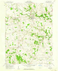
1960 Map of Leesburg
USGS Topo · Published 1962About this map
Leesburg serves as a central hub for this Highland County landscape, where the Baltimore and Ohio railroad cuts a diagonal line through the townships of Fairfield and Paint. The map captures a quintessential mid-century Ohio agricultural pattern, defined by numerous family and community cemeteries like Antioch Cem and Hapsbrough Cem that dot the high ground between creek drainages. To the south, the village of Samantha sits near the Township Sch and Township Cem, illustrating the localized nature of rural education and civil service before further consolidation.
Find a feature on this map
37 named features on this map. Tap any name to fly to it.
Don’t see what you’re looking for? This feature index may not catch every label — zoom into the map to look around manually.
Map Details
Editions of this 1960 Leesburg Map
3 editions found
Other maps of this area

1915 · Bainbridge
USGS Topo · 1:48,000

1917 · Bainbridge
USGS Topo · 1:62,500

1917 · Greenfield
USGS Topo · 1:62,500

1917 · Hillsboro
USGS Topo · 1:62,500

1917 · Sabina
USGS Topo · 1:62,500

1943 · Sabina
USGS Topo · 1:62,500

1944 · Hillsboro
USGS Topo · 1:62,500

1944 · Greenfield
USGS Topo · 1:62,500

1947 · Columbus
USGS Topo · 1:250,000

1960 · Greenfield
USGS Topo · 1:24,000