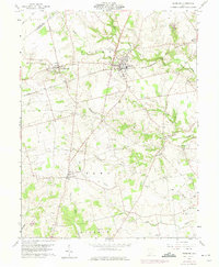
1960 Map of Leesburg
USGS Topo · Published 1975About this map
Leesburg and the surrounding townships of Fairfield, Penn, and Paint appear here in a transition period, documented originally in 1960 and updated with 1974 revisions. The landscape is defined by the Baltimore and Ohio railroad corridor, which links the settlements of Highland, Leesburg, and East Monroe across the northern reaches of the map. This area is particularly rich in family and community history, evidenced by a high density of small rural burial grounds like Antioch Cem and Swadley Cem.
Find a feature on this map
33 named features on this map. Tap any name to fly to it.
Don’t see what you’re looking for? This feature index may not catch every label — zoom into the map to look around manually.
Map Details
Editions of this 1960 Leesburg Map
3 editions found
Other maps of this area

1915 · Bainbridge
USGS Topo · 1:48,000

1917 · Bainbridge
USGS Topo · 1:62,500

1917 · Greenfield
USGS Topo · 1:62,500

1917 · Hillsboro
USGS Topo · 1:62,500

1917 · Sabina
USGS Topo · 1:62,500

1943 · Sabina
USGS Topo · 1:62,500

1944 · Hillsboro
USGS Topo · 1:62,500

1944 · Greenfield
USGS Topo · 1:62,500

1947 · Columbus
USGS Topo · 1:250,000

1960 · Greenfield
USGS Topo · 1:24,000