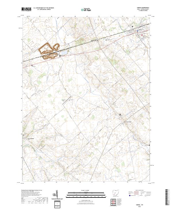
2023 Map of Sabina
USGS Topo · Published 2023About this map
Sabina serves as the primary hub of activity in this portion of Clinton County, showing a well-defined street grid including Grand Ave and E Washington St. The surrounding landscape is defined by the headwaters of several significant drainages, including Anderson Fork, Todd Fork, and Cowan Creek. These watercourses carve through the agricultural terrain, which is dotted with numerous small family and community burial grounds that suggest a long history of local settlement.
Find a feature on this map
58 named features on this map. Tap any name to fly to it.
Don’t see what you’re looking for? This feature index may not catch every label — zoom into the map to look around manually.
Map Details
Editions of this 2023 Sabina Map
This is the sole edition of this map. No revisions or reprints were ever made.
Other maps of this area

1907 · Blanchester
USGS Topo · 1:62,500

1916 · Octa
USGS Topo · 1:62,500

1917 · Xenia
USGS Topo · 1:62,500

1917 · Sabina
USGS Topo · 1:62,500

1943 · Sabina
USGS Topo · 1:62,500

1944 · Octa
USGS Topo · 1:62,500

1947 · Columbus
USGS Topo · 1:250,000

1955 · Port William
USGS Topo · 1:24,000

1960 · Martinsville
USGS Topo · 1:24,000
1960 · Leesburg
USGS Topo · 1:24,000