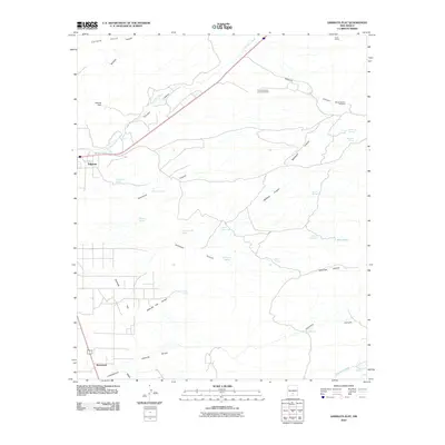
2010 Map of Sabinata Flat
USGS Topo · Published 2010About this map
The community of Tularosa occupies the western edge of this High Desert landscape, where the town’s grid meets the alluvial reach of Sabinata Flat. As seen in 2010, the area is defined by a sophisticated network of water management features essential for life in the Tularosa Basin, including Mitchell Dam and numerous named water sources like Burro Water Hole and Chicken Ranch Spring. The terrain transitions from the low Sabinata Flat Arroyo toward the rising elevations of the Coyote Hills, carved by deep drainage systems such as Tularosa Canyon and Tecolote Canyon. Southeast of the main settlement, the smaller cluster at Alamorosa sits near the Laborcita Arroyo, illustrating the historical pattern of development following the seasonal watercourses and spring lines. These numerous springs, from Gomez Spring to Dripping Spring, reflect the vital importance of groundwater to the ranching operations and early settlements throughout Otero County.
Find a feature on this map
34 named features on this map. Tap any name to fly to it.
Don’t see what you’re looking for? This feature index may not catch every label — zoom into the map to look around manually.
Map Details
Editions of this 2010 Sabinata Flat Map
This is the sole edition of this map. No revisions or reprints were ever made.
Other maps of this area

1916 · Tularosa
USGS Topo · 1:125,000

1916 · Point Of Sands
USGS Topo · 1:125,000

1948 · Tularosa
USGS Topo · 1:62,500

1948 · Holloman
USGS Topo · 1:62,500

1950 · Alamogordo
USGS Topo · 1:62,500

1950 · Mescalero
USGS Topo · 1:62,500

1954 · Carlsbad
USGS Topo · 1:250,000

1954 · Tularosa
USGS Topo · 1:250,000

1955 · Las Cruces
USGS Topo · 1:250,000

1955 · Roswell
USGS Topo · 1:250,000