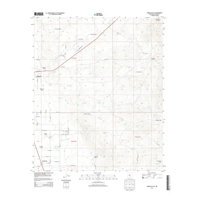
2013 Map of Sabinata Flat
USGS Topo · Published 2013About this map
Tularosa sits at the western edge of this landscape where the desert floor meets the rising foothills of the Sacramento Mountains. This 2013 survey shows the expansion of residential roads like Sun Valley Rd and Rattlesnake Rd south and east of the main town center, reaching toward the alluvial plains of Sabinata Flat. The area is defined by its arid-land hydrology, with a dense network of water sources such as Wallenberg Spring, Whitmore Spring, and the descriptively named Chicken Ranch Spring and Burro Water Hole. Deep canyons, including Ysletano Canyon and Martinez Canyon, cut through the terrain, illustrating the dramatic drainage patterns that flow toward the Tularosa Basin. Modern development, like the Alamorosa settlement, contrasts with historical transit routes such as Old Mescalero Rd, showing how the local infrastructure has adapted to the challenging topography of the New Mexico high desert.
Find a feature on this map
64 named features on this map. Tap any name to fly to it.
Don’t see what you’re looking for? This feature index may not catch every label — zoom into the map to look around manually.
Map Details
Editions of this 2013 Sabinata Flat Map
This is the sole edition of this map. No revisions or reprints were ever made.
Other maps of this area

1916 · Tularosa
USGS Topo · 1:125,000

1916 · Point Of Sands
USGS Topo · 1:125,000

1948 · Tularosa
USGS Topo · 1:62,500

1948 · Holloman
USGS Topo · 1:62,500

1950 · Alamogordo
USGS Topo · 1:62,500

1950 · Mescalero
USGS Topo · 1:62,500

1954 · Carlsbad
USGS Topo · 1:250,000

1954 · Tularosa
USGS Topo · 1:250,000

1955 · Las Cruces
USGS Topo · 1:250,000

1955 · Roswell
USGS Topo · 1:250,000