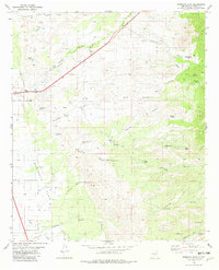
1982 Map of Sabinata Flat
USGS Topo · Published 1982About this map
Sabinata Flat dominates the lower central portion of this 1980s landscape, where the arid terrain is defined by a complex network of arroyos and canyons. Water management is a primary feature of this New Mexico quadrangle, evidenced by Mitchell Dam and the prominent Aqueduct cutting through the western portion. The map identifies numerous localized water sources essential for ranching and survival, such as Chicken Ranch Spring, Wallenberg Spring, and Burro Water Hole.
Find a feature on this map
36 named features on this map. Tap any name to fly to it.
Don’t see what you’re looking for? This feature index may not catch every label — zoom into the map to look around manually.
Map Details
Editions of this 1982 Sabinata Flat Map
This is the sole edition of this map. No revisions or reprints were ever made.
Other maps of this area

1916 · Tularosa
USGS Topo · 1:125,000

1916 · Point Of Sands
USGS Topo · 1:125,000

1948 · Tularosa
USGS Topo · 1:62,500

1948 · Holloman
USGS Topo · 1:62,500

1950 · Alamogordo
USGS Topo · 1:62,500

1950 · Mescalero
USGS Topo · 1:62,500

1954 · Carlsbad
USGS Topo · 1:250,000

1954 · Tularosa
USGS Topo · 1:250,000

1955 · Las Cruces
USGS Topo · 1:250,000

1955 · Roswell
USGS Topo · 1:250,000