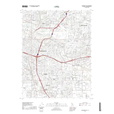
2018 Map of Sacramento East
USGS Topo · Published 2018About this map
The American River divides the northern suburbs from the urban core in this 2018 survey of the California state capital. The landscape is defined by its extensive network of sloughs and creeks, including Arcade Cr, Strong Ranch Slough, and Chicken Ranch Slough, which weave through established neighborhoods like Arden Town and Swanston. The map captures a dense collection of institutional landmarks, featuring the California State Univ - Sacramento campus along the river and several historic burial grounds such as East Lawn Memorial Cem and Home of Peace Cem. To the south, residential pockets like Fruitridge Manor and Lemon Hill are situated near the Sacramento Executive Airport, while the Southern Pacific railroad line continues to mark the industrial and transit corridor running through Brighton and Polk.
Find a feature on this map
45 named features on this map. Tap any name to fly to it.
Don’t see what you’re looking for? This feature index may not catch every label — zoom into the map to look around manually.
Map Details
Editions of this 2018 Sacramento East Map
This is the sole edition of this map. No revisions or reprints were ever made.
Other maps of this area

1891 · Sacramento
USGS Topo · 1:125,000

1892 · Sacramento
USGS Topo · 1:125,000

1893 · Sacramento
USGS Topo · 1:125,000

1894 · Lodi
USGS Topo · 1:125,000

1902 · Fairoaks
USGS Topo · 1:62,500

1907 · Davisville
USGS Topo · 1:62,500

1908 · Courtland
USGS Topo · 1:62,500

1909 · Elk Grove
USGS Topo · 1:31,680

1909 · Florin
USGS Topo · 1:31,680

1911 · Brighton
USGS Topo · 1:31,680