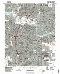
1992 Map of Sacramento East
USGS Topo · Published 1997About this map
The American River carves a wide arc through this urban landscape, separating the residential expansions of North Sacramento and Swanston from the core city. This early 1990s layout illustrates the massive logistical and educational infrastructure defining the regional economy, from the sprawling Sacramento Army Depot in the southeast to the riverside campus of California State University Sacramento. A high density of civic and religious landmarks is evident, including the concentrated Broadway Cemeteries complex featuring St Josephs Cemetery and the Home of Peace Cemetery.
Find a feature on this map
89 named features on this map. Tap any name to fly to it.
Don’t see what you’re looking for? This feature index may not catch every label — zoom into the map to look around manually.
Map Details
Editions of this 1992 Sacramento East Map
This is the sole edition of this map. No revisions or reprints were ever made.
Other maps of this area

1891 · Sacramento
USGS Topo · 1:125,000

1892 · Sacramento
USGS Topo · 1:125,000

1893 · Sacramento
USGS Topo · 1:125,000

1894 · Lodi
USGS Topo · 1:125,000

1902 · Fairoaks
USGS Topo · 1:62,500

1907 · Davisville
USGS Topo · 1:62,500

1908 · Courtland
USGS Topo · 1:62,500

1909 · Elk Grove
USGS Topo · 1:31,680

1909 · Florin
USGS Topo · 1:31,680

1911 · Brighton
USGS Topo · 1:31,680