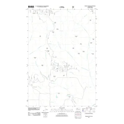
2011 Map of Saddle Butte
USGS Topo · Published 2011About this map
Sunbeam Ranch and the H A McEachan Ranch anchor this high-elevation landscape in Asotin County, where ridges and deep canyons define the southeastern corner of Washington. The map traces a rugged topography of named points like Mount Harrible and Saddle Butte, revealing how human occupation is concentrated along the high plateaus of Grouse Flat and the small settlement at Grouse. Transportation in this area is dictated by the terrain, with routes like Grouse Flat Rd and Joe Mace Rd skirting dramatic drops into Go Devil Canyon and James Canyon. Water is a precious resource in this environment, marked by numerous named points such as Misery Spring and Hewitt Spring, which historically supported ranching and early backcountry travel. The presence of the Misery Spring Campground near Cabin Saddle indicates the area's transition into a recreational landscape by the early 21st century.
Find a feature on this map
45 named features on this map. Tap any name to fly to it.
Don’t see what you’re looking for? This feature index may not catch every label — zoom into the map to look around manually.
Map Details
Editions of this 2011 Saddle Butte Map
This is the sole edition of this map. No revisions or reprints were ever made.
Other maps of this area

1937 · Pomeroy
USGS Topo · 1:96,000

1942 · Pomeroy
USGS Topo · 1:125,000

1943 · Saddle Butte
USGS Topo · 1:62,500

1946 · Saddle Butte
USGS Topo · 1:62,500

1955 · Pullman
USGS Topo · 1:250,000

1955 · Grangeville
USGS Topo · 1:250,000

1958 · Pullman
USGS Topo · 1:250,000

1959 · Grangeville
USGS Topo · 1:250,000

1967 · Troy
USGS Topo · 1:24,000

1967 · Eden
USGS Topo · 1:24,000