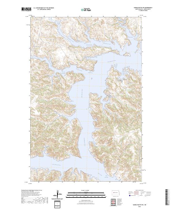
2024 Map of Saddle Butte SW
USGS Topo · Published 2024About this map
The Little Missouri River meanders deeply through the broken badlands of Dunn County before emptying into the massive reservoir of Lake Sakakawea. This landscape is defined by the intricate flooded finger-bays that reach into the surrounding coulees, including Sakakawea Bay, Hidatsa Bay, and Wolf Chief Bay. The name-heavy topography reflects the indigenous heritage and geographic history of the Fort Berthold region, with features like Charging Eagle Bay and Moccasin Creek marking the intersections of land and water. Bureau of Indian Affairs routes, such as BIA Rd 17 and BIA Rd, provide the primary access through the high ridges and deep draws like Ash Coulee and Sagebrush Coulee. The map illustrates the complex shoreline formed by the inundation of the Missouri River valley, creating a labyrinth of water and earth in the heart of the North Dakota plains.
Find a feature on this map
24 named features on this map. Tap any name to fly to it.
Don’t see what you’re looking for? This feature index may not catch every label — zoom into the map to look around manually.
Map Details
Editions of this 2024 Saddle Butte SW Map
This is the sole edition of this map. No revisions or reprints were ever made.
Other maps of this area

1953 · Watford City
USGS Topo · 1:250,000

1957 · Watford City
USGS Topo · 1:250,000

1967 · Watford City
USGS Topo · 1:250,000

1970 · Halliday NE
USGS Topo · 1:24,000

1970 · Hay Flat
USGS Topo · 1:24,000

1970 · String Buttes
USGS Topo · 1:24,000

1970 · Halliday NW
USGS Topo · 1:24,000
1970 · Saddle Butte
USGS Topo · 1:24,000

1970 · Dunn Center NE
USGS Topo · 1:24,000

1970 · Mandaree SE
USGS Topo · 1:24,000