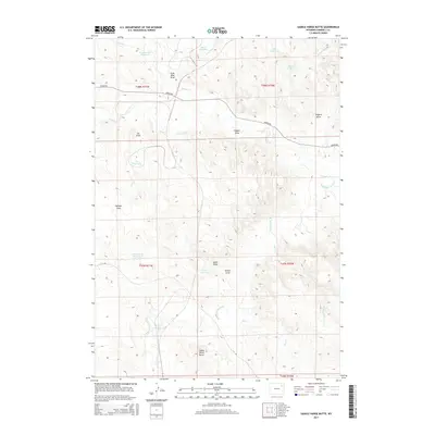
2015 Map of Saddle Horse Butte
USGS Topo · Published 2015About this map
Saddle Horse Butte overlooks a landscape defined by the winding course of the Belle Fourche River and its numerous seasonal tributaries. This Campbell County terrain is shaped by a dense network of erosional features, including Gold Mine Draw, Enyard Draw, and Kicken Draw, which reveal the complex drainage patterns feeding into the river. The area's ranching and livestock history is visible through a series of named water catchments and stock ponds, such as Tisdale Stock Reservoir, Mary Reservoir, and Enyard Reservoir. The presence of Gold Mine Cr and its associated draw suggests early prospecting efforts in this high plains region. This map illustrates the intersection of sparse infrastructure, like Bishop Rd, with the natural hydrology of Deer Cr and Caballo Cr, providing a clear view of the rural Wyoming range as it appeared in the early 21st century.
Find a feature on this map
31 named features on this map. Tap any name to fly to it.
Don’t see what you’re looking for? This feature index may not catch every label — zoom into the map to look around manually.
Map Details
Editions of this 2015 Saddle Horse Butte Map
This is the sole edition of this map. No revisions or reprints were ever made.
Other maps of this area

1954 · Gillette
USGS Topo · 1:250,000

1955 · Newcastle
USGS Topo · 1:250,000

1955 · Gillette
USGS Topo · 1:250,000

1958 · Gillette
USGS Topo · 1:250,000

1958 · Newcastle
USGS Topo · 1:250,000

1962 · Gillette
USGS Topo · 1:250,000

1971 · Coyote Draw
USGS Topo · 1:24,000

1971 · Coon Track Creek
USGS Topo · 1:24,000

1971 · The Gap SW
USGS Topo · 1:24,000

1971 · Whitetail Creek
USGS Topo · 1:24,000