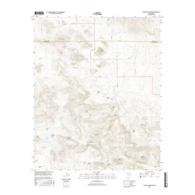
2016 Map of Saddle Mountain
USGS Topo · Published 2016About this map
The boundary between Kiowa Co and Comanche Co divides the high, ridged landscape of the western Wichita Mountains. This 2016 survey documents a terrain dominated by significant peaks and drainage basins, including the notable Saddle Mountain and Blue Mtn in the north. Historically minded researchers will note the Saddle Mountain Cem near Saddle Mountain Cr, representing local heritage in this upland region. The southern half of the map is defined by a dense network of canyons and ridges, such as Geronimo Ridge and Moose Canyon, which feed into various water sources like Medicine Cr and W Cache Cr. These features, along with names like Black Bear Spring and Gray-Wolf Spring, reflect the local nomenclature tied to the area's geography and history.
Find a feature on this map
53 named features on this map. Tap any name to fly to it.
Don’t see what you’re looking for? This feature index may not catch every label — zoom into the map to look around manually.
Map Details
Editions of this 2016 Saddle Mountain Map
This is the sole edition of this map. No revisions or reprints were ever made.
Other maps of this area

1937 · Cache
USGS Topo · 1:48,000

1937 · Quanah Mountain
USGS Topo · 1:24,000

1942 · Cache
USGS Topo · 1:62,500

1949 · Mount Scott
USGS Topo · 1:24,000

1949 · Cooperton
USGS Topo · 1:62,500

1949 · Quanah Mountain
USGS Topo · 1:24,000

1950 · Snyder
USGS Topo · 1:62,500

1950 · Saddle Mountain
USGS Topo · 1:62,500

1955 · Lawton
USGS Topo · 1:250,000

1956 · Saddle Mountain
USGS Topo · 1:24,000