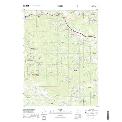
2019 Map of Saddleback Mountain
USGS Topo · Published 2019About this map
Idaho Springs sits at the northern edge of this high-elevation survey, where Clear Creek carves a path toward Clear Creek Canyon. The terrain is defined by the massive peaks of the Arapaho National Forest, including Saddleback Mtn and Santa Fe Mtn, which separate the watershed of the main creek from the intricate drainage of Beaver Brook. The map reveals a landscape of modern residential developments like Echo Hills and Pine Valley that have integrated into the steep topography of the Front Range. Notable for recreation and local history, the area includes the Scott Lancaster Memorial Trail and the Central City Pkwy, connecting the mining-era legacy of the canyon floor to the high ridges of Bergen Peak. Smaller settlements like Brookvale and Rosedale anchor the southern valleys near Bear Cr, illustrating the continued habitation of these mountain corridors.
Find a feature on this map
65 named features on this map. Tap any name to fly to it.
Don’t see what you’re looking for? This feature index may not catch every label — zoom into the map to look around manually.
Map Details
Editions of this 2019 Saddleback Mountain Map
This is the sole edition of this map. No revisions or reprints were ever made.
Other maps of this area

1899 · West Denver
USGS Topo · 1:125,000

1903 · Georgetown
USGS Topo · 1:62,500

1905 · Central City
USGS Topo · 1:62,500

1905 · Georgetown
USGS Topo · 1:62,500

1906 · Blackhawk
USGS Topo · 1:62,500

1910 · Central City
USGS Topo · 1:62,500

1912 · Central City
USGS Topo · 1:62,500

1942 · Central City
USGS Topo · 1:24,000

1942 · Black Hawk
USGS Topo · 1:24,000

1942 · Ralston Buttes
USGS Topo · 1:24,000