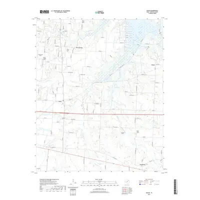
2019 Map of Sadler
USGS Topo · Published 2019About this map
Sadler and Southmayd anchor this Grayson County landscape, where the northern reaches give way to the sprawling waters of Lake Texoma. The map reveals a transition from traditional agricultural land to the water-dominated geography of the Big Mineral Arm. Small family and community landmarks such as Basin Springs Cem, Christian Chapel Cem, and Sadler Cem are preserved among a network of rural routes like FM 901 and Old Sherman Rd.
Find a feature on this map
98 named features on this map. Tap any name to fly to it.
Don’t see what you’re looking for? This feature index may not catch every label — zoom into the map to look around manually.
Map Details
Editions of this 2019 Sadler Map
This is the sole edition of this map. No revisions or reprints were ever made.
Other maps of this area

1901 · Denison
USGS Topo · 1:125,000

1954 · Sherman
USGS Topo · 1:250,000

1958 · Dorchester
USGS Topo · 1:24,000

1958 · Gordonville
USGS Topo · 1:62,500

1958 · Denison Dam
USGS Topo · 1:62,500

1958 · Sherman NW
USGS Topo · 1:24,000

1958 · Whitesboro
USGS Topo · 1:62,500

1958 · Sherman
USGS Topo · 1:250,000

1958 · Sherman
USGS Topo · 1:62,500
1976 · Gordonville SE
USGS Topo · 1:24,000