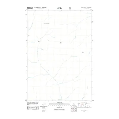
2011 Map of Safety Creek
USGS Topo · Published 2011About this map
Marble Creek and its many tributaries carve through this high-altitude landscape of Valley County, defining the drainage patterns between Lookout Mountain Ridge and Shellrock Ridge. The map documents a sparse human imprint in a region dominated by steep terrain and watercourses, most notably at the Venable Mine near the northwestern boundary. Small named locations such as Belleco and Black Pole suggest isolated mountain outposts or survey points within the Forest Service lands. The intricate stream network, including the vividly named South Fork Holy Terror Creek and Dynamite Creek, reveals a landscape shaped by narrow canyons and seasonal runoff. For the researcher, this 2011 survey provides a baseline of the modern forest road network as it intersects with long-established geographical features and small-scale mining history.
Find a feature on this map
19 named features on this map. Tap any name to fly to it.
Don’t see what you’re looking for? This feature index may not catch every label — zoom into the map to look around manually.
Map Details
Editions of this 2011 Safety Creek Map
This is the sole edition of this map. No revisions or reprints were ever made.
Other maps of this area

1930 · Casto
USGS Topo · 1:125,000

1956 · Elk City
USGS Topo · 1:250,000

1957 · Challis
USGS Topo · 1:250,000

1960 · Elk City
USGS Topo · 1:250,000

1960 · Challis
USGS Topo · 1:250,000

1962 · Mormon Mtn
USGS Topo · 1:24,000

1962 · Norton Ridge
USGS Topo · 1:24,000

1962 · Shellrock Peak
USGS Topo · 1:24,000

1963 · Challis
USGS Topo · 1:250,000

1973 · Center Mtn
USGS Topo · 1:24,000