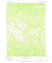
1973 Map of Safety Creek
USGS Topo · Published 1975About this map
Mining operations and remote backcountry trails define this high-elevation landscape within the Payette National Forest and Boise National Forest. The map documents the remnants of early 20th-century extraction, featuring the Venable Mine, the Sunnyside Prospect, and several unnamed Mines concentrated near Belleco (Site). Evidence of past habitation is visible at the Ruins located along the drainage of Safety Creek, suggesting a era when these isolated canyons were more active than they are today.
Find a feature on this map
33 named features on this map. Tap any name to fly to it.
Don’t see what you’re looking for? This feature index may not catch every label — zoom into the map to look around manually.
Map Details
Editions of this 1973 Safety Creek Map
This is the sole edition of this map. No revisions or reprints were ever made.
Other maps of this area

1930 · Casto
USGS Topo · 1:125,000

1956 · Elk City
USGS Topo · 1:250,000

1957 · Challis
USGS Topo · 1:250,000

1960 · Elk City
USGS Topo · 1:250,000

1960 · Challis
USGS Topo · 1:250,000

1962 · Mormon Mtn
USGS Topo · 1:24,000

1962 · Norton Ridge
USGS Topo · 1:24,000

1962 · Shellrock Peak
USGS Topo · 1:24,000

1963 · Challis
USGS Topo · 1:250,000

1973 · Center Mtn
USGS Topo · 1:24,000