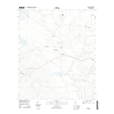
2014 Map of Safford
USGS Topo · Published 2014About this map
Bogue Chitto and Orrville anchor this corner of Dallas County, where the landscape is defined by the winding course of Bogue Chitto Creek and its many tributaries. The area is dotted with small settlements such as Eleanor, Westbrook, and Salem, reflecting a traditional rural Alabamian settlement pattern of small crossroads and community hubs. Numerous small family or community burial grounds, including Saint John Cem, Martins Station Cem, and New Hope Cem, are scattered across the terrain, providing essential reference points for local history and genealogical research. The hydrography of the region is notably intricate, with Chaney Creek and Bear Creek threading through the lowlands towards larger bodies of water like McHugh Lake and East Ables Lake. The layout of the road network, including Al-22, connects these dispersed communities across a landscape of subtle elevation changes and riparian corridors.
Find a feature on this map
50 named features on this map. Tap any name to fly to it.
Don’t see what you’re looking for? This feature index may not catch every label — zoom into the map to look around manually.
Map Details
Editions of this 2014 Safford Map
This is the sole edition of this map. No revisions or reprints were ever made.
Other maps of this area

1953 · Montgomery
USGS Topo · 1:250,000

1956 · Montgomery
USGS Topo · 1:250,000

1957 · Montgomery
USGS Topo · 1:250,000

1957 · Carlowville
USGS Topo · 1:62,500

1958 · Selma
USGS Topo · 1:62,500

1968 · Uniontown East
USGS Topo · 1:24,000

1968 · Browns
USGS Topo · 1:24,000

1968 · Safford
USGS Topo · 1:24,000

1968 · Central Mills
USGS Topo · 1:24,000

1974 · Crumptonia
USGS Topo · 1:24,000