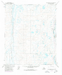
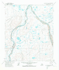
1971 Map of Sagavanirktok A-4
USGS Topo · Published 1977About this map
The Sagavanirktok River and Toolik River define this North Slope landscape as it underwent significant industrial development during the 1970s. This period marks a transformative moment in Alaska's history, centered on the activity at Happy Valley Camp and the nearby Happy Valley Airstrip. The most notable feature is the progress of The Trans-Alaska Pipeline (Under Construction), which is shown as it was being established through this remote terrain. The map provides a unique look at the early logistical hubs required for the pipeline project, including a secondary Camp and the land marker noted as Bound. These features highlight the intersection of massive infrastructure projects with the Arctic wilderness before the permanent footprint of modern energy transport was fully completed.
Find a feature on this map
7 named features on this map. Tap any name to fly to it.
Don’t see what you’re looking for? This feature index may not catch every label — zoom into the map to look around manually.
Map Details
Editions of this 1971 Sagavanirktok A-4 Map
2 editions found
Other maps of this area

1951 · Sagavanirktok D-5
USGS Topo · 1:250,000

1951 · Brooks
USGS Topo · 1:250,000

1956 · Philip Smith Mountains
USGS Topo · 1:250,000

1956 · Sagavanirktok
USGS Topo · 1:250,000

1958 · Sagavanirktok
USGS Topo · 1:250,000

1964 · Philip Smith Mountains
USGS Topo · 1:250,000

1964 · Sagavanirktok
USGS Topo · 1:250,000
1971 · Sagavanirktok B-4
USGS Topo · 1:63,360
1971 · Philip Smith Mountains D-3
USGS Topo · 1:63,360
1971 · Sagavanirktok B-3
USGS Topo · 1:63,360