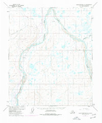
1971 Map of Sagavanirktok B-3
USGS Topo · Published 1977About this map
The Sagavanirktok River valley is the focal point of this 1970s survey, documenting the early infrastructure of Alaska's North Slope during the energy boom. A defining element of the landscape is The Trans-Alaska Pipeline (Under Construction), shown as it was being integrated into the tundra alongside the river's eastern bank. This map captures the industrial character of the era with the Pumping Sta and the settlement at Sagwon, which served as critical staging grounds for petroleum development. Beyond these modern insertions, the terrain remains defined by the braided networks of the Ivishak River and Echooka River. The presence of a Winter Road and Winter Trail reflects the seasonal transportation realities of the Arctic, where permanent road networks were still in their infancy. Small topographic markers like Gard and Hak punctuate the vast wetland plains, providing essential navigation points in an otherwise repeating landscape of ponds and streams.
Find a feature on this map
11 named features on this map. Tap any name to fly to it.
Don’t see what you’re looking for? This feature index may not catch every label — zoom into the map to look around manually.
Map Details
Editions of this 1971 Sagavanirktok B-3 Map
2 editions found
Other maps of this area

1951 · Sagavanirktok D-5
USGS Topo · 1:250,000

1956 · Sagavanirktok
USGS Topo · 1:250,000

1958 · Sagavanirktok
USGS Topo · 1:250,000

1964 · Sagavanirktok
USGS Topo · 1:250,000
1971 · Sagavanirktok C-2
USGS Topo · 1:63,360
1971 · Sagavanirktok B-4
USGS Topo · 1:63,360
1971 · Sagavanirktok C-3
USGS Topo · 1:63,360
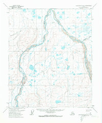
1971 · Sagavanirktok B-3
USGS Topo · 1:63,360
1971 · Sagavanirktok A-3
USGS Topo · 1:63,360
1971 · Sagavanirktok A-2
USGS Topo · 1:63,360