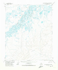
1971 Map of Sagavanirktok C-5
USGS Topo · Published 1974About this map
The Kuparuk River winds through the northern portion of this 1971 survey, carving a complex series of oxbows and braided channels across the North Slope landscape. This document, produced just after the first aerial photography of the region in 1970, captures a wilderness at the dawn of modern exploration. The southern terrain rises significantly toward the White Hills, where the contour lines tighten against the expansive wetlands of the coastal plain. A solitary Winter Trail cuts across the northern tundra, marking the primary overland route for seasonal movement across this remote Alaskan territory. The land lines shown here represent unmarked locations predetermined by the Bureau of Land Management, reflecting a period when the vast interior remained largely unsurveyed on the ground.
Find a feature on this map
3 named features on this map. Tap any name to fly to it.
Don’t see what you’re looking for? This feature index may not catch every label — zoom into the map to look around manually.
Map Details
Editions of this 1971 Sagavanirktok C-5 Map
This is the sole edition of this map. No revisions or reprints were ever made.
Other maps of this area

1951 · Sagavanirktok D-5
USGS Topo · 1:250,000

1952 · Umiat
USGS Topo · 1:250,000
1955 · Sagavanirktok D-5
USGS Topo · 1:63,360

1955 · Sagavanirktok D-4
USGS Topo · 1:63,360
1955 · Umiat D-1
USGS Topo · 1:63,360

1956 · Sagavanirktok
USGS Topo · 1:250,000

1956 · Umiat
USGS Topo · 1:250,000

1958 · Sagavanirktok
USGS Topo · 1:250,000

1964 · Umiat
USGS Topo · 1:250,000

1964 · Sagavanirktok
USGS Topo · 1:250,000