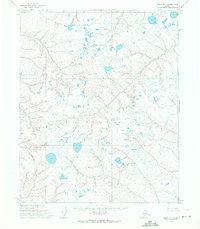
1955 Map of Umiat D-1
USGS Topo · Published 1971About this map
The Kachemach River and Miluveach River define this stretch of the Alaskan North Slope during the mid-1950s. This territory is characterized by a dense network of thaw lakes and ponds, showing the intricate hydrology of the permafrost landscape before large-scale industrial development reached the region. The U.S. Army Topographic Command utilized photogrammetric methods from 1955 aerial photography to document these waterways as they meander through the Colville River drainage area. While the terrain lacks established settlements or infrastructure, the map provides an essential record of the pristine Arctic tundra and its drainage patterns, offering a precise view of the hydrological state of the Arctic Coastal Plain at the time of the 1955 survey.
Find a feature on this map
2 named features on this map. Tap any name to fly to it.
Don’t see what you’re looking for? This feature index may not catch every label — zoom into the map to look around manually.
Map Details
Editions of this 1955 Umiat D-1 Map
2 editions found
Other maps of this area

1951 · Harrison Bay
USGS Topo · 1:250,000

1951 · Beechey Point
USGS Topo · 1:250,000

1951 · Sagavanirktok D-5
USGS Topo · 1:250,000

1952 · Umiat
USGS Topo · 1:250,000

1955 · Harrison Bay
USGS Topo · 1:250,000

1955 · Beechey Point
USGS Topo · 1:250,000

1955 · Beechey Point A-5
USGS Topo · 1:63,360

1955 · Umiat D-2
USGS Topo · 1:63,360

1955 · Harrison Bay A-2
USGS Topo · 1:63,360
1955 · Sagavanirktok D-5
USGS Topo · 1:63,360