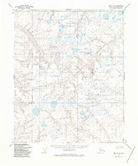
1955 Map of Umiat D-1
USGS Topo · Published 1986About this map
Kachemach River winds through this North Slope landscape as it appeared in the mid-1950s, during a period of extensive photogrammetric mapping by the Geological Survey and the Defense Mapping Agency. The terrain is characterized by a dense network of thaw lakes and thermokarst depressions, illustrating the complex hydrological patterns of the Alaskan tundra before significant modern infrastructure reached this part of the borough. The absence of roads or trails throughout the entire quadrangle emphasizes the isolation of the region during this era of exploration. While primarily a topographic study of drainage and elevation, the map provides a foundational view of the native environment as documented by early aerial photography and field annotations, preserving the state of the watershed and permafrost features for environmental and geographical research.
Find a feature on this map
1 named feature on this map. Tap any name to fly to it.
Don’t see what you’re looking for? This feature index may not catch every label — zoom into the map to look around manually.
Map Details
Editions of this 1955 Umiat D-1 Map
2 editions found
Other maps of this area

1951 · Harrison Bay
USGS Topo · 1:250,000

1951 · Beechey Point
USGS Topo · 1:250,000

1951 · Sagavanirktok D-5
USGS Topo · 1:250,000

1952 · Umiat
USGS Topo · 1:250,000

1955 · Harrison Bay
USGS Topo · 1:250,000

1955 · Beechey Point
USGS Topo · 1:250,000

1955 · Beechey Point A-5
USGS Topo · 1:63,360

1955 · Umiat D-2
USGS Topo · 1:63,360

1955 · Harrison Bay A-2
USGS Topo · 1:63,360
1955 · Sagavanirktok D-5
USGS Topo · 1:63,360