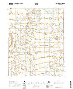
2017 Map of Sagavanirktok D-2 NE
USGS Topo · Published 2017About this map
The Kadleroshilik River meanders across this Arctic landscape, carving a complex network of channels and braids through the low-lying terrain of the North Slope. This environment is defined by its vast wetland systems and numerous thermokarst lakes, typical of the coastal plain's permafrost-driven hydrology. To the southeast, the Shaviovik River enters the frame, marking another significant drainage route toward the Beaufort Sea. The area is mapped within the public land survey system across several townships, including t7n r17e and t7n r18e, illustrating the vast, unpopulated stretches of the Alaskan wilderness before any significant modern infrastructure or permanent settlements reached this specific quadrant.
Find a feature on this map
8 named features on this map. Tap any name to fly to it.
Don’t see what you’re looking for? This feature index may not catch every label — zoom into the map to look around manually.
Map Details
Editions of this 2017 Sagavanirktok D-2 NE Map
This is the sole edition of this map. No revisions or reprints were ever made.
Other maps of this area

1951 · Beechey Point
USGS Topo · 1:250,000

1951 · Sagavanirktok D-5
USGS Topo · 1:250,000

1955 · Beechey Point
USGS Topo · 1:250,000

1955 · Beechey Point A-1
USGS Topo · 1:63,360

1955 · Beechey Point A-2
USGS Topo · 1:63,360
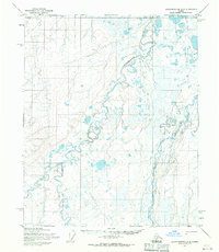
1955 · Sagavanirktok D-2
USGS Topo · 1:63,360
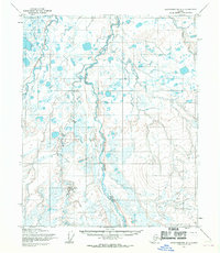
1955 · Sagavanirktok D-1
USGS Topo · 1:63,360

1956 · Sagavanirktok
USGS Topo · 1:250,000

1958 · Sagavanirktok
USGS Topo · 1:250,000

1960 · Beechey Point
USGS Topo · 1:250,000