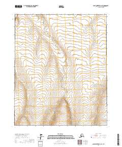
2017 Map of Sagavanirktok D-3 NE
USGS Topo · Published 2017About this map
Tundra and wetlands dominate this remote region of the North Slope, documented during a 2017 survey by the U.S. Geological Survey. The landscape is defined by complex hydrological patterns and permafrost features, with no permanent settlements or roads noted across the vast acreage of T7n R15e and T7n R16e. The topography is exceptionally subtle, relying on precise elevation data from the National Elevation Dataset to delineate the drainage towards the Arctic coast. This map primarily serves as a record of the Public Land Survey System boundaries, including the intersections of T8n R15e and T6n R15e, in a territory where natural landforms are the only landmarks.
Find a feature on this map
5 named features on this map. Tap any name to fly to it.
Don’t see what you’re looking for? This feature index may not catch every label — zoom into the map to look around manually.
Map Details
Editions of this 2017 Sagavanirktok D-3 NE Map
This is the sole edition of this map. No revisions or reprints were ever made.
Other maps of this area

1951 · Beechey Point
USGS Topo · 1:250,000

1951 · Sagavanirktok D-5
USGS Topo · 1:250,000

1955 · Beechey Point
USGS Topo · 1:250,000

1955 · Beechey Point A-2
USGS Topo · 1:63,360

1955 · Beechey Point A-3
USGS Topo · 1:63,360

1955 · Sagavanirktok D-3
USGS Topo · 1:63,360
1955 · Sagavanirktok D-2
USGS Topo · 1:63,360

1956 · Sagavanirktok
USGS Topo · 1:250,000

1958 · Sagavanirktok
USGS Topo · 1:250,000

1960 · Beechey Point
USGS Topo · 1:250,000