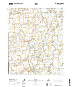
2017 Map of Sagavanirktok D-5 NE
USGS Topo · Published 2017About this map
Kuparuk River meanders across this Arctic landscape, creating a complex network of braided channels and oxbow lakes characteristic of the North Slope's permafrost-underlain terrain. The hydrology here is defined by extreme seasonal shifts, where these large waterways dominate the flat tundra. In the southeastern portion of the sheet, the Toolik River enters the frame, converging with the broader drainage patterns that flow toward the Beaufort Sea. This 2017 survey illustrates the intricate wetland systems and thermokarst features that exist between the major river systems, reflecting a landscape shaped entirely by water and ice. The map provides a precise look at the township and range divisions, including t7n r10e and t8n r11e, which organize this otherwise remote and feature-sparse stretch of the Alaskan interior.
Find a feature on this map
8 named features on this map. Tap any name to fly to it.
Don’t see what you’re looking for? This feature index may not catch every label — zoom into the map to look around manually.
Map Details
Editions of this 2017 Sagavanirktok D-5 NE Map
This is the sole edition of this map. No revisions or reprints were ever made.
Other maps of this area

1951 · Beechey Point
USGS Topo · 1:250,000

1951 · Sagavanirktok D-5
USGS Topo · 1:250,000

1955 · Beechey Point
USGS Topo · 1:250,000

1955 · Beechey Point A-5
USGS Topo · 1:63,360

1955 · Beechey Point A-4
USGS Topo · 1:63,360
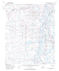
1955 · Sagavanirktok D-5
USGS Topo · 1:63,360

1955 · Sagavanirktok D-4
USGS Topo · 1:63,360

1956 · Sagavanirktok
USGS Topo · 1:250,000

1958 · Sagavanirktok
USGS Topo · 1:250,000

1960 · Beechey Point
USGS Topo · 1:250,000